maui: geography and history
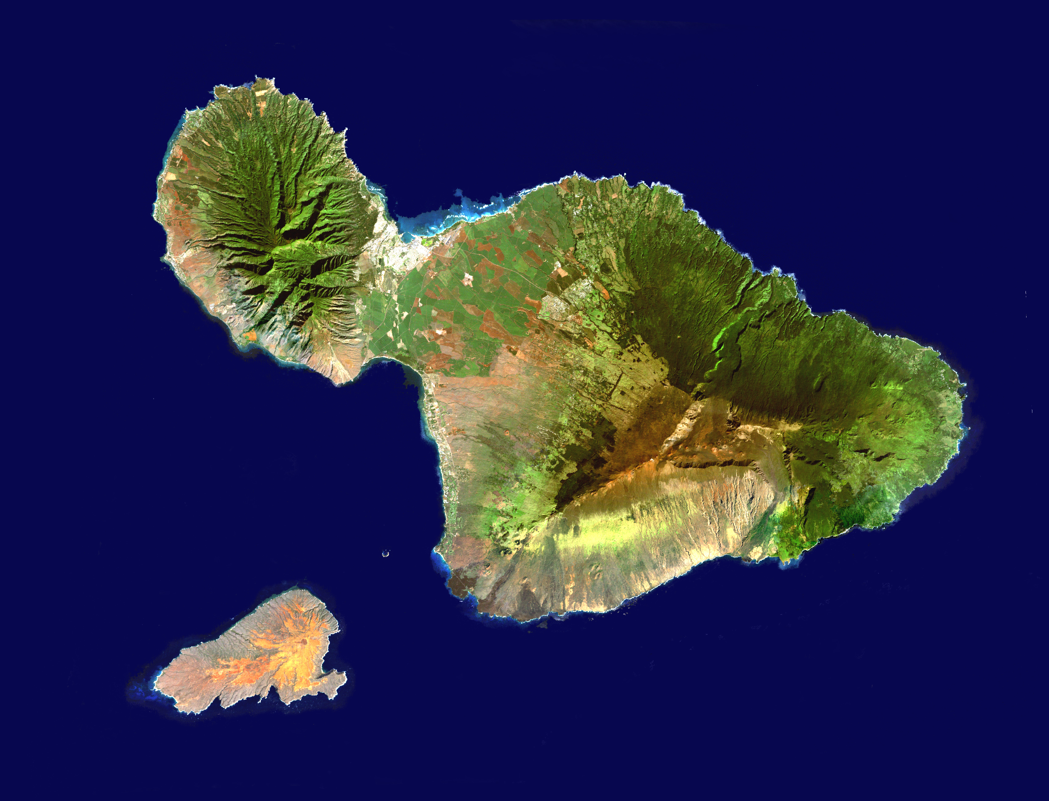
Maui has two halves: West Maui, on the northwest side, dominated by the West Maui mountains, and; the southeast side formed by Haleakala, a large, dormant volcano. The valley between the two parts of the island used to be farmland for sugar cane. Some still grows next to the road from the Kahului airport. That valley between the two halves of Maui is what gives the island one of its names: "The Valley Isle". (click on the picture for a bigger version.)
geography
The chain of the Hawaiian Islands runs from north west to south east and were formed in that order overtop of the same undersea volcanic source. Thanks to shifting plates on the ocean floor, the islands are very slowly moving towards Japan and have been for millions of years. Over those millions of years, new islands formed in succession over the volcanic source. Hence, the oldest Hawaiian islands are to the north west of the chain (such as Kauai and Oahu) and the youngest, the "Big Island" of Hawai'i, is still forming in the south west. That continuous formation is most evident in the form of Kilauea - an active volcano.
The trade winds blow from the northeast, collecting moisture from the Pacific Ocean. When the trade winds meet the hills on the northeast coasts of Maui, they drop the moisture as rainfall. As a result, the northeast sides of the West Maui mountains are one of the wettest places on earth and the drive from Kahului to Hana takes you through tropical forests and over many beautiful streams and waterfalls. In contrast, on the leeward, west side of the island, the natural vegetation can be quite sparse, and the beaches are mostly sunny and dry. We like the west side for that reason.
history
Dome volcanos
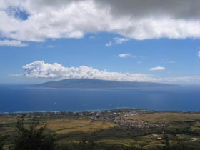
Unlike the volcanos of children's books, the volcanos that formed Hawai'i are dome volcanos - they are shaped like a soldier's shield. The dome shape is visible in this picture of Lana'i taken from high above Lahaina.